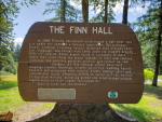


But it was time to move on and so back down the way we came heading back toward I5 which we reached by about noon. Twenty minutes later we exited on to Highway 503 taking us toward Cougar and the Ape Cave. Before too long however, we stopped for lunch. I found another of the Heritage Markers I had looked up, this one was for The Finn Hall, which commemorates Finnish immigrant’s building used as a library and community center over 100 years ago.
 After lunch it was onward to the Ape Cave which we got to by 2pm. The Ape Cave is actually a lava tube formed during an eruption of Mt. St. Helens thousands of years ago. Long covered by land, trees, etc., it was first discovered by a logger named Lawrence Johnson in 1947, but got its name from boy scout troop led by Harry Reese in the early 1950’s. The troop was named the St. Helens Apes and so the tube was named in their honor. The central hole to access the caves is quite large and has a nice stairway down.
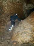
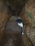
  But you better have a really good flashlight because there are no lights down there and thus is absolutely pitch black. Tim and I had strong headlamps and were ready to go. I had been here before on my own, but didn’t have a good flashlight. From this point in the caves there are two ways to travel: uphill for about a 1.5 mile hike that is climbing over boulders, rocks, and other obstructions, or a half mile hike downhill to where the cave ends. We decided on the longer hike. It was long and cool to start with, but eventually you generate some pretty good heat, especially when you’re in motorcycle clothing. There were two spots in particular that were pretty tricky to get over. You can hike down the tube too, but I’m glad we hiked up. It’s much easier to hike up than climbing down places where you can’t see to put a foot down correctly. We passed a number of groups with small kids which got slowed down by the tricky parts. I’d guess it took us an hour and a half to hike it, then 30 minutes or so to hike back down above ground. We were there about 2 hours and I’m really glad this time I got to hike it.
 Leaving the cave complex, we headed back on the road which is technically Forest Road 90, not highway 503, but regardless, it runs along the north of the Swift Reservoir formed by the Lewis River Dam. The original plan I had took us due south through Carson and then east along state highway 14. But Tim and I decided to do a more scenic ride toward Mt. Adams and stay in Trout Lake. It was a beautiful ride though the roads were somewhat iffy here and there. A few spots of no-pavement, but not too big a deal.
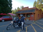
  The biggest problem was that due to the roads not really being maintained, there were dips and potholes that you had to really watch out for. I bottomed out once hitting one too fast to avoid. But we eventually made our way to Trout Lake and just decided to camp at the local campground which was practically deserted. And it had showers too. We ate at the local restaurant which was delicious and then set up camp for the night. Unfortunately they had a burn ban on so it was a smokeless camp. But we camped beside a little creek and because hardly anyone was there had a nice quiet evening.
Tom Clark
I'm a Senior Software Engineer at Intellitect, living in Spokane, Washington. I also do a little development work on the side. And I love riding motorcycles all over the country with my friends.